
A successful architectural scale model does more than replicate a structure. It tells the complete story of a project by showing how the building or infrastructure interacts with its surroundings. Whether the project is a bridge, water treatment facility, or commercial development, the terrain and landscape provide the context needed to understand the design. Without them, even the most accurate model can leave important questions unanswered. This is why 3D Architectural Model Making & Manufacturing is about much more than producing a scaled-down structure.
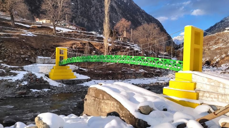
For architects, engineers, government agencies, and infrastructure developers, understanding the relationship between a project and its environment is essential during planning and decision-making. A bridge crossing a river, for example, cannot be evaluated by looking at the bridge alone. The surrounding terrain, water flow, elevation changes, and nearby access routes all influence how the project is perceived and how effectively it solves real-world challenges.
The UNOPS Swat Water Bridge project is a practical example of why terrain and landscaping are just as important as the structure itself. Commissioned as an urgent architectural model, the objective was to create a realistic representation of the bridge while accurately showcasing the surrounding river, terrain, and landscape. Rather than presenting an isolated bridge model, the final result provided a complete picture of the proposed development, making it easier for stakeholders to understand the project in its intended environment.
Why Context Is Essential in Architectural Scale Models
One of the most common challenges in infrastructure presentations is helping stakeholders visualise how a project fits within its surroundings. Engineering drawings and digital renderings provide valuable technical information, but they often require specialist knowledge to interpret. A physical model bridges that gap by presenting the project in a clear and accessible format.
However, a model that only includes the main structure tells only part of the story.
For infrastructure projects such as bridges, roads, dams, and water facilities, the surrounding environment is often just as important as the structure itself. Rivers influence bridge alignment, terrain affects construction methods, and nearby landforms shape accessibility and long-term planning. Ignoring these elements can result in a model that looks impressive but fails to communicate the complete design.
The UNOPS Swat Water Bridge project addressed this challenge by ensuring that the surrounding landscape became an integral part of the model rather than an afterthought.
The UNOPS Swat Water Bridge Project
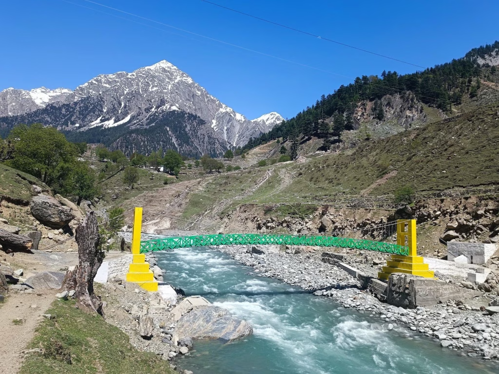
The UNOPS Swat Water Bridge model was developed under a demanding schedule while maintaining the level of accuracy expected for a public infrastructure project. Although the delivery timeframe was short, the objective remained clear: produce a detailed model that accurately represented not only the bridge but also the surrounding landscape.
The completed model measured approximately 1.5 ‘2 feet, providing enough space to represent the bridge, river, terrain, and nearby site conditions without sacrificing portability. This scale allowed viewers to understand the complete setting while making the model practical for meetings, presentations, and project discussions.
From the beginning, the focus was on creating context.
Instead of placing the bridge on a flat presentation base, the model incorporated:
- Natural terrain contours
- The river flowing beneath the bridge
- Surrounding landforms
- Site topography
- Areas adjacent to the bridge alignment
This approach transformed the model into a visual representation of the project’s environment rather than simply a scaled bridge.
Recreating the River and Terrain
One of the most distinctive features of the project was the realistic representation of the river.
Instead of using painted surfaces to suggest water, the production team used pigmented resin to recreate the river flowing beneath the bridge. The resin provided transparency and depth, creating a natural appearance that enhanced the realism of the entire model.
The surrounding terrain was developed with equal attention to detail. Contours were carefully shaped to reflect the site’s natural landscape, allowing viewers to understand changes in elevation and the relationship between the bridge and the surrounding environment.
This combination of realistic water, terrain, and structural elements helped communicate the project’s purpose far more effectively than a bridge model alone.
Combining Technology for Greater Accuracy
Producing a model with this level of environmental detail required more than traditional fabrication techniques.
For the UNOPS Swat Water Bridge, BD3D combined 3D printing with precision acrylic fabrication to manufacture the bridge structure and supporting components. This hybrid approach ensured that complex architectural details remained accurate while maintaining a clean, professional finish.
Different manufacturing methods were selected according to the requirements of each component. Structural elements benefited from the precision of 3D printing, while acrylic provided durability and crisp architectural edges. Together, these technologies allowed the project to maintain a high level of detail while meeting the client’s urgent requirements.
The result was a model that accurately represented both the engineering design and the surrounding landscape, demonstrating how experienced architectural model makers use multiple production methods to achieve the best outcome.
Creating a Model That Reflects the Entire Project
The greatest strength of the UNOPS Swat Water Bridge model was that it presented the project as a complete environment rather than an isolated structure.
Stakeholders could immediately understand:
- How the bridge crossed the river.
- The surrounding terrain and elevation changes.
- The relationship between the structure and nearby land.
- The overall context of the project site.
By integrating terrain, landscaping, and realistic water features into the model, the project communicated far more information than architectural drawings alone. It demonstrated that high-quality 3D architectural models are most effective when they represent not only the structure but also the environment in which it exists.
How Terrain and Landscaping Improved Project Communication
Once the UNOPS Swat Water Bridge model was completed, it became much more than a visual display. It served as a practical communication tool that allowed engineers, project managers, consultants, and stakeholders to discuss the project using a single, easy-to-understand reference.
Instead of interpreting multiple engineering drawings or switching between digital renderings, viewers could examine the bridge within its actual environment. The surrounding terrain, river, and landscape immediately explained how the structure interacted with the site. This reduced ambiguity and helped technical and non-technical audiences understand the proposal without requiring extensive engineering knowledge.
The inclusion of terrain and landscaping also encouraged more productive project discussions. Rather than focusing only on the bridge itself, stakeholders could evaluate the relationship between the structure and its surroundings, making it easier to review design intent and overall site planning.
Why Realistic Site Context Matters
For infrastructure projects, every surrounding feature contributes to the overall design. Rivers influence bridge positioning, terrain affects structural connections, and nearby landforms determine accessibility and future development.
The UNOPS Swat Water Bridge model demonstrated how these details strengthen an architectural presentation.
By accurately representing the site, the model helped viewers understand:
- How the bridge aligned with the river.
- Changes in ground elevation surrounding the structure.
- The visual relationship between the bridge and nearby landscape.
- The overall scale of the project within its environment.
- How natural features influenced the bridge’s placement.
Without this context, the bridge would have appeared disconnected from the landscape, limiting the model’s ability to communicate the full scope of the project.
Material Selection Played an Important Role
Creating a realistic landscape required selecting materials that accurately represented different elements of the site while maintaining durability.
For the UNOPS Swat Water Bridge model, multiple materials worked together to achieve this balance.
| Model Element | Material | Purpose |
|---|---|---|
| Bridge structure | Precision 3D printed components | Accurate architectural detailing |
| Structural base | Acrylic | Strength, stability, and clean presentation |
| River | Pigmented resin | Realistic water depth and transparency |
| Terrain | Sculpted landscape materials | Natural topography and site contours |
Each material was chosen because it performed a specific role within the model. Rather than focusing only on appearance, the goal was to create a durable presentation model that accurately represented the project while remaining suitable for transportation and repeated use during meetings and exhibitions.
Lessons from the UNOPS Swat Water Bridge Project
The project reinforced several important principles that apply to architectural models across infrastructure, engineering, and construction sectors.
A Structure Alone Does Not Tell the Whole Story
A bridge is only one part of a much larger environment. Including terrain, waterways, and surrounding landforms allows viewers to understand how the project fits into the real world.
Context Improves Understanding
Accurate landscaping makes complex engineering projects easier to interpret. Decision-makers can evaluate the relationship between different site elements without relying solely on technical drawings.
Material Selection Supports Realism
Using pigmented resin to represent the river and combining 3D printing with acrylic fabrication produced a model that balanced technical accuracy with visual realism. Every material contributed to communicating the project more effectively.
Attention to Detail Creates Better Models
Small details such as terrain contours, river edges, and surrounding landscape features may seem secondary, but together they transform a standard model into a realistic representation of the complete development.
Choosing an Architectural Model Making Company for Infrastructure Projects
Infrastructure developments often require more than a simple building model. Projects involving bridges, water treatment facilities, transport networks, and industrial sites demand models that accurately represent both the structure and its surroundings.
When selecting an architectural model making company, it is worth considering whether they can:
| Capability | Why It Matters |
| Interpret engineering and CAD drawings | Ensures technical accuracy throughout the model. |
| Create realistic terrain and landscaping | Helps communicate the complete project. |
| Use multiple manufacturing techniques | Produces better quality and greater flexibility. |
| Deliver urgent projects without compromising standards | Keeps planning and presentation schedules on track. |
| Build presentation-ready models | Supports stakeholder meetings, exhibitions, and approvals. |
Experienced architectural model makers understand that every project has unique requirements. Their role is not only to reproduce a structure but also to communicate the surrounding environment with the same level of accuracy.
The Value of Complete Architectural Models
The UNOPS Swat Water Bridge project demonstrates that the most effective 3D architectural models are those that represent the entire project rather than focusing on a single structure.
By combining the bridge, realistic terrain, surrounding landscape, and a carefully crafted river using pigmented resin, the model provided stakeholders with a comprehensive understanding of the proposed development. This holistic approach made the model more useful during planning discussions and presentations because it reflected the project’s real-world setting.
For infrastructure projects where geography directly influences design, incorporating terrain and landscaping is not an optional enhancement—it is an essential part of accurately communicating the project.
Conclusion
Terrain and landscaping are fundamental elements of a high-quality architectural scale model. They provide the context that allows stakeholders to understand how a project relates to its environment, making presentations clearer and planning discussions more productive.
The UNOPS Swat Water Bridge project illustrates how 3D Architectural Model Making & Manufacturing extends beyond recreating a bridge. Through the careful integration of terrain, realistic river effects using pigmented resin, precision 3D printing, acrylic fabrication, and detailed site modelling, the project delivered a complete representation of the proposed development rather than an isolated structure.
For architects, engineers, infrastructure planners, and developers looking for custom 3D architectural models, partnering with experienced architectural model makers can make a significant difference. As a trusted 3D model making company, BD3D combines technical expertise, advanced manufacturing technologies, and skilled craftsmanship to create models that communicate projects with clarity, accuracy, and professionalism.